Sunday, June 30, 2013

Lanesboro

The Root River State Trail goes right through
downtown Lanesboro.
In early June we headed to Lanesboro in southern Minnesota to celebrate Cristin's birthday.  This is a unique area in Minnesota, part of the Driftless Area, in which the most recent glaciers, which receded 10,000 years ago, did not extend ths far south. However, the melt water from the glaciers sculpted the landscape, creating steep blufflands and river valleys amid the rolling hills and fertile farm fields. Southeast Minnesota is also underlain by extensive karst bedrock. The topography combined with the underlying geology results in many springs, trout streams, sink holes, and caves.  The most surprsing result, though, is there are no lakes in Fillmore County!   Be sure to see our companion blog post on our visit to Mystery Cave State Park.

The trail stays close to the Root River or its South Branch.
This bridge crosses the confluence of those rivers.
Lanesboro is biker's paradise as it sits near the center of a vast network of state bike trails.  The Root River Trail passes right through town. There are many miles of trout streams.  Canoeing, kayaking, and tubing are also very popular.  Lanesboro is considered the bed-and-breakfast capitol of Minnesota.  There are also several campgrounds in the area, two public ones right in town.

There are  a bunch of restaurants and cafes, a winery, and a very well-designed professional theatre.  We saw "Blithe Spirit" there on Saturday evening and enjoyed it very much.  As much as we liked Laneboro, don't look for a grocery store, a pharmacy, a liquor store  -- you'll be out of luck!

Here is slide show with additional pictures from Lanesboro as well locations eastward along the Root River trail. Click on the small arrow or "play" button to advance.


Monday, May 20, 2013

Gettysburg, PA


Cemetery Ridge
Cristin and I traveled to Pennsylvania Dutch country the first weekend of May for her cousin's wedding in Maytown, PA.  We flew into Harrisburg, the state's capitol, the early morning the day before the wedding. We decided to spend the afternoon at Gettysburg. I have long wanted to see the National Military Park here where the epic Civil War battle was fought.  It represents the largest battle ever fought in the western hemisphere and resulted in 51,000 casualties and was the turning point of the Civil War.


The First Minnesota Infantry monument as seen from the top of the
Pennsylvania State monument. Little Round Top is the high point
visible in the distance.  
We toured the excellent museum and took a guided 2-hour bus tour of the battlefield. We then drove up to Cemetery Ridge to check out closer the First Minnesota Infantry Regiment monument and the State of Pennsylvania monument.  These monuments are located near each other at what was the center of the Union line, the area targeted by Pickett's famous and ill-fated charge on Day 3 of the battle.

On day 2, Confederate forces nearly broke through the Union lines here. The 262 men of the First Minnesota were ordered to make a suicide charge into an on-rushing force now estimated to be at least 5 times their number. They suffered 215 casualties but were able to protect the line and Union artillery positions for the precious minutes it took for reinforcements to arrive. The 83.1 percent casualty rate stands to this day as the largest loss by any surviving military unit in U.S. history during a single day's engagement.  
The inscription on the First Minnesota monument is here.
The Pennsylvania State monument is in the background. 
The Pennsylvania State Monumentt is the largest at Gettysburg.
Over 34,000 Pennsylvania troops fought here.
On day 3, the 47 survivors of the First Minnesota were by ill-chance placed  nearby at  "The Angle", the only location along the Union line in which Pickett's forces briefly broke thru.   Another 17 men died. A second, smaller  Minnesota monument marks this location.  This is also the location referred to as the 'High Water Mark' because it marked not only the furthest the Confederates penetrated on Day 3, but also marks the beginning of demise of the Confederacy.


The Angle


The High Water Mark

Little Round Top protected the Union's left flank while Culp's Hill protected the right flank. Some of the most intense fighting occurred at these locations as Lee's forces tried in vain to overrun the flanks.
Little Round Top.  The Wheat Field battleground is below.
The view towards Gettysburg from the viewing tower at Culp's Hill
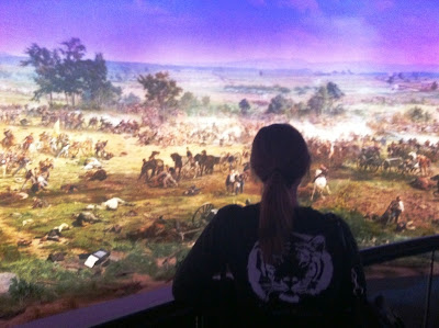
The museum is one of the best I have ever visited, but we only had an hour to hurry thru it. We also checked out the Cyclorama, a very unique 360 degree painted panorama of Pickett's Charge that has been enhanced with multi-media special effects and also includes a diorama.  Hard to explain, you have to see it.


General Lee's traveled with this bed, bureau, and medicine chest.  This is just one
of the many incredible artifacts on display in the museum. 

Here is slide show with additional pictures. Click on the small arrow or "play" button to advance


Monday, April 22, 2013

Kiawah Island, South Carolina


Cristin and I spent over a week in April 2013 at her parents vacation town home on Kiawah Island, which is about 20 miles from Charleston.  We enjoyed our days relaxing on the beach, beach combing on bikes, and viewing nature in the extensive ponds, marshes, and floodplain forests of the island. We went on a guided, sunset, kayak tour in the marsh. We spent an afternoon in Charleston touring Ft. Sumter.

Jim and Truman
     Cristin's parents Jim and Sandi joined us about midway through our stay, along with her 4-legged brother Truman, everyone's favorite. We really enjoyed seeing and visiting with them.  We all went to Charleston one day.  Cristin and her mom went to the aquarium while her dad and I went to Patriots Point and toured the USS Yorktown, a WWII era aircraft carrier, as well as destroyer and a submarine.  We had dinner at a great place in downtown Charleston on the harbor in downtown. On our last full day, we all played tennis and enjoyed the friendly competition.

Please see the companion blog Historic Charleston  for more on our time spent there.  We also spent an afternoon in Savannah, GA., and filed this brief blog post here (coming soon).


Sunday, April 21, 2013

Historic Charleston

This 33-star U.S. Flag flew over Fort Sumter
 the day the Civil War began in 1861.
Cristin and I spent parts of two days in Charleston, South Carolina when vacationing on nearby Kiawah Island  (click here for the companion blog).  We toured Fort Sumter one day and the other day Cristin and her mom went to the Charleston Aquarium while her dad and I went to Patriot's Point and toured the USS Yorktown, a WWII aircraft carrier, as well as destroyer and submarine.


Fort Sumter 

Fort Sumter is national monument located on a tiny island near the entrance to Charleston Harbor. This is where the Civil War began.  The first shots of the war occurred when Confederate troops fired cannon on Fort Sumter, a federal fort.  The battle lasted just 34 hours when the under-manned and ill-equipped Union forces surrendered.

I knew the 'first shot'  part of the story but I didn't know that Union forces tried for 4 years to take the fort back.  It provided great cover for Confederate supply ships that ran the Union blockade into Charleston Harbor.  I also didn't realize that there are several other historic forts and batteries in and near Charleston Harbor that were used extensively in the Civil War.  Fort Moutrie won the first American victory over the British Navy in the War of Independence.  The Union assault of nearby Battery Wagner was depicted in the movie 'Glory'.

Wednesday, February 6, 2013

North Shore, North Woods

A jet's contrail points the way along the Birch Hill Loop at Gooseberry Falls SP
On the first weekend of February we took advantage of a last-minute discount at the Baptism River Inn, located near Tettegouche State Park and Silver Bay, MN.  Although we had been in north east Minnesota just two weeks prior, the conditions for cross country skiing were now good, unlike previously. The weekend was relaxing and rejuvinating. We got in some good sking, ate some good food, and enjoyed the good life.


After a fancy breakfast of salmon scrambled eggs, aspargus, a scone and tasty coffee, we headed to the Northwoods Ski Touring Trail just outside of Silver Bay.  I skied this system with the Rovers in 2011; click here to see my 2011 trip report.  We hadn't been skiing much this winter so we opted not to tackle the long trip out-and-back to Tettegouche Camp. We skied exclusively on the Northwoods system.  We did take the 1.1 K spur trail to Bean Lake, something new for me.  Cristin really enjoyed the skiing here, which features a well-groomed, narrow, woodsy, single track on easy-to-moderately difficult trails.

The spur trail to Bean Lake


Bean Lake is surrounded by high ridges,
one of which includes the Superior Hiking Trail
After skiing, we headed to Beaver Bay for mid-afternoon meal at the Northern Lights Cafe. We had had an excellent meal here. We recommend the walleye sandwich and the cranberry chicken sandwhich!   The cafe is right off of MN Hwy 61. It has a pleasant back porch and an outdoor patio area with great views of Lake Superior.


Northern Lights at Northern Lights Cafe.
This gnome was of several on the patio at the unique Northern Lights Cafe
on Lake Superior in Beaver Bay, MN.

Rocky Taconite welcomes visitors
to Silver Bay, MN, a mining town. 
After a stop at iconic Zup's grocery store in Silver Bay, we headed back to the fabulous Baptism River Inn.  There are only 4 guest rooms at this newer B&B,  each one with a private bathroom with a jacuzzi.  We stayed in the River Room and felt fortuate as it was very quite and private, with great views outside and lots natural lighting during the day.

The Baptism River and the rugged terrain of the area is visible from our room's deck.
The sauna as viewed from our room.

On Sunday we skied the very nice Birch Hill Loop at Gooseberry Falls State Park.


Cristin herringbones her way up Birch Hill.
 
A 360 degree panarama of the area awaits at the top of Birch Hill,
including views of Lake Superior as seen here,
Jack appreciates the nice view, made even nicer knowing it
is all downhill now!  What goes up must come down.


THE END

Wednesday, January 23, 2013

Winter Wilderness Weekend


Nanook of the North?  Nope, just Cristin
enjoying the winter wilderness! 
During the third week of January, Cristin and I spent a long weekend at Camp Minogyn, a very unique YMCA camp located 30 miles from Grand Marais just off the Gunflint Trail, a road. The camp is on West Bearskin Lake at the doorstep of the Boundary Waters Canoe Area Wilderness (BWCAW) and only a few miles from Canada.  The winter wilderness weekend trip was offered thru the Friends of the Boundary Waters, an advocacy group devoted to protection of the BWCA.  The guests at Camp Minogyn are referred to as 'campers'.


 Please note: click on any picture to expand it

This area is one of the snowiest in Minnesota and the third week of January is on average the coldest week of the year in Minnesota.  So I was not surprised that our trip to Camp Minogyn coincided with the arrival of significant snow followed by an Arctic Express of extended subzero weather and bitter winds.    Here is a summary from the National Weather Service on the arctic air. 

Jack employs all available accessories  to stay warm on a
 blustery snowshoe hike returning from the summit
of Caribou Rock (in background).